Steve Rowell
Ultimate High Ground
2007-2009, 2014
“At the Millennium, the dream of territorial empire seems dead, buried practically and morally. But imperializing global discourses resist, recast in terms of an altered spatiality of globalization, as connection and communication, networks of infinite individual points linked across invisible channels over a frictionless surface, generating and transforming a virtual globe.”
— Denis Cosgrove, Apollo’s Eye: A Cartographic Genealogy of the Earth in the Western Imagination, 2003
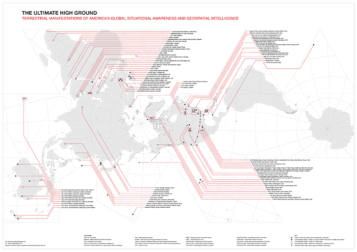
The Ultimate High Ground project is about America abroad. As a research project, it is comprised of a growing database of photographs, video, audio field recordings, and maps, created, found, and collected. The focus is on the terrestrial manifestation of a global network of remote bases, orbiting satellites, and undisclosed or speculated places on foreign soil. It is also about the atmosphere that surrounds us, charged with coded transmissions, as a critical conduit between these far-flung places. Known as “ground stations” or “Earth stations” these satellite communication, radar detection, and intelligence processing sites are fixed technological nodes in a fluid cartography, in orbiting constellations, constantly re-defined by current and future geopolitical strategies. These are enigmatic, extraterritorial places on the landscape, dwarfed by their own global sensing capabilities and geospatial and technological importance. Streaming incomprehensible amounts of encrypted data in an internal network, these ground stations form the liminal terrain of a largely invisible, geographically discontiguous, and seemingly infinite construct of extended perception. The title is taken from a 2003 report published by the RAND corporation, “Mastering the Ultimate High Ground. Next Steps in the Military Uses of Space”. The term “high ground”, in this context, is a known military expression, referring to a geographic position of elevated terrain which is tactically advantageous. Space provides the ultimate overlook, in many, many ways.


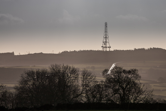

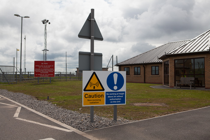


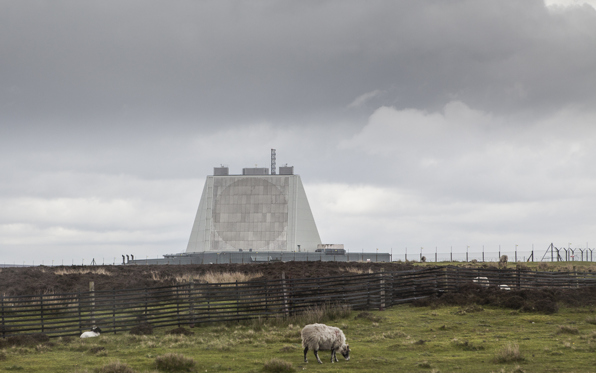
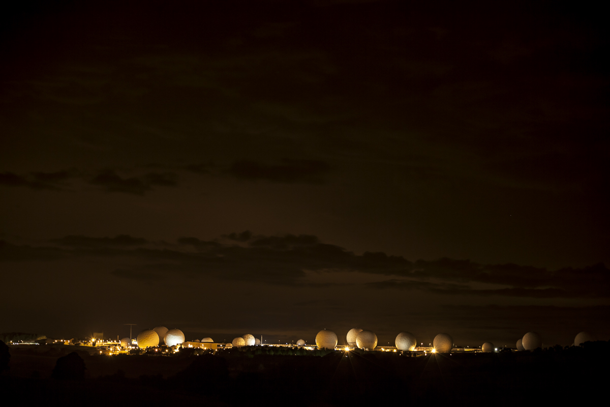
These photographs represent only two American SIGINT sites in the UK and one former one in Germany.
2014
On display January 24–March 16, 2014 in the group exhibition Counterintelligence, curated by Charles Stankievech, at the Justina M. Barnicke Gallery, Toronto.
2011
For an online version of this project, including a high resolution version of the map above, please see my 2011 article for Triple Canopy.
2009
More on the 2009 exhibition, Dark Places, which included an iteration, Ultimate High Ground UK at the John Hansard Gallery, co-curated by Neal White and the Arts Catalyst. This iteration featured 2 walls of photographic prints, maps, a binder full of documents given to me by the legendary anti-NSA activist Anne Lee, as well as a four-screen video and sound installation. (a sample of this video can be seen in the triple canopy piece).
* Campbell's 1993 (!) television program, The Hill, explains his revelations in detail.


Located in the North Yorkshire Dales on sovereign British soil, RAF Menwith Hill is said to be the world’s most powerful signals intelligence satellite teleport or "listening post". Despite the RAF (Royal Air Force) affiliation, this is not a British base; with over 2,000 employees, military personnel, and contractors, Menwith Hill is operated by members of the American Intelligence community. The National Security Agency, National Reconnaissance Office, and National Geospatial Intelligence Agency all "have a presence" at this installation. Locals have been protesting this base since the 1980s when it was first revealed to be a US military intelligence site by the reporter Duncan Campbell, who, with the aid of activists like Anne Lee , exposed the secret NSA program code-named ECHELON*, the precursor to global surveillance programs such as PRISM (SIGAD US-984XN), exposed by whistleblower Edward Snowden in 2013. Anne Lee toured me around Menwith Hill's perimeter in December 2007, educating me on the points of interest in the region, such as this unique vantage point.
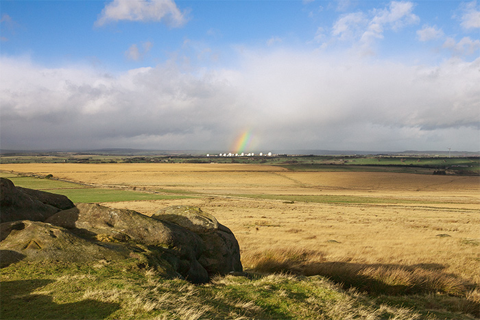
Undisclosed amounts of encrypted data streams between orbiting satellites above and the numerous radomes (white teflon spheres on the horizon) below at the base, through classified interception and transmission equipment, in the form of invisible waves of electromagnetic radiation. Rainbows, which occur in the spectrum of light visible to us, are caused by sunlight refracting and reflecting through water droplets in the earth's atmosphere, acting like some form of massive global prism.