Steve Rowell
Loop Feedback Loop:
The Big Picture of Traffic Control In Los Angeles
2004
In collaboration with the Center for Land Use Interpretation.
![]()
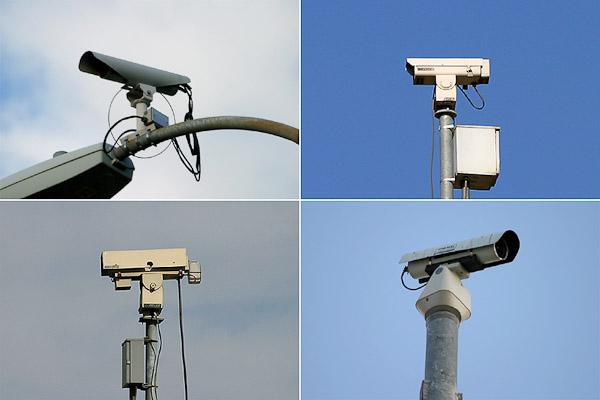
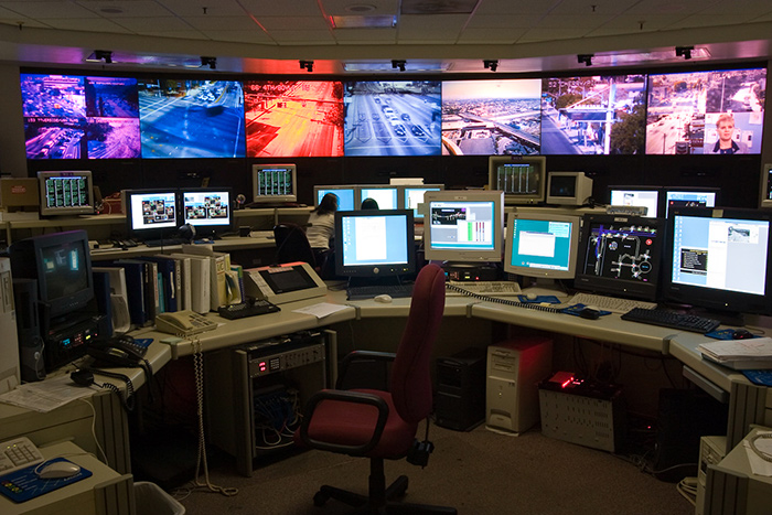
To keep things moving, the highway and surface street network of Los Angeles has become the most instrumented and managed of any American city. Sensors embedded in the ground and on poles measure rates and volumes, and deliver their data to control centers where it is assembled into a dynamic image of the collective traffic picture. Increasingly automated, signals also flow out from these control rooms, adjusting timings of lights at intersections and freeway metering ramps, dispatching incident response teams, and updating traffic reports, including live maps on the web. These in turn effect the flow, feeding back into the system and changing its form, as indicated by the sensors that send their signals to the control rooms: the loops feeding back to the loops.
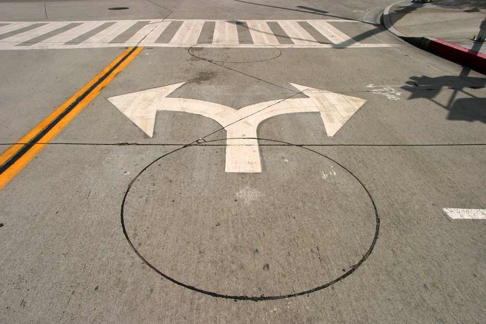
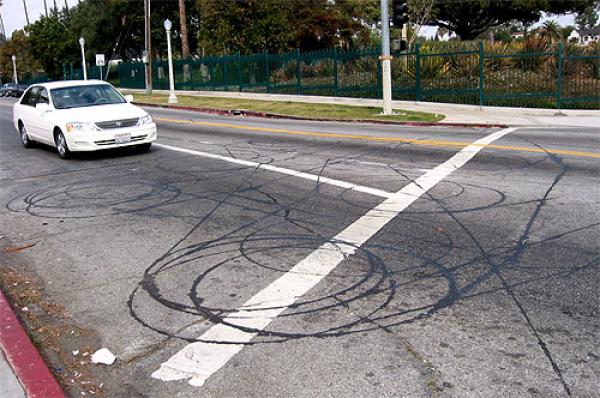
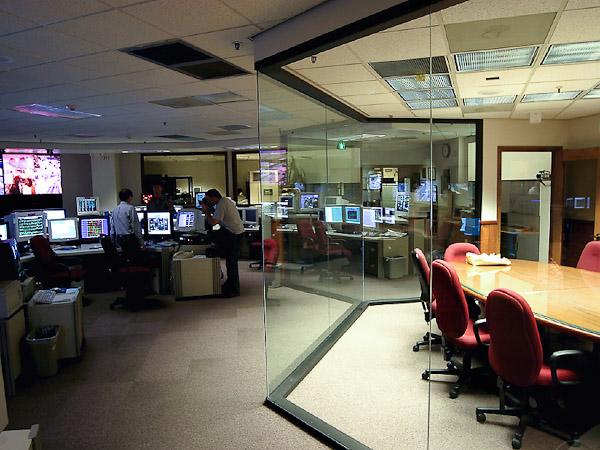
Inductive loops are the electronic bedrock of the traffic management system, with more than fifty thousand of them in the metropolitan area. Loops are generally composed of an insulated wire, set into a shallow trough cut into the pavement to form a square or circular “loop” approximately six feet wide. Each loop is usually visibly linked to a connection point at the curb, and then wired to the traffic control system. The magnetic field generated by low voltage running through the loop is altered by large metal objects passing over it, and this disturbance is detected by the loop and registered by the electronics connected to it on the curb. Each vehicle passing over a loop is a click in the system. Complex intersections can have dozens of loops, and major streets and highways are dotted with them. A series of loops can measure the speed at which cars travel, as well as how many are on the road. Intersections can count the cars that line up before automatically triggering the signal.
The 2004 exhibit, produced by the CLUI’s Transportation Systems Program, in association with the Institute for Advanced Architecture, was on view from March 5 to April 4, 2004, at the Center’s exhibit space on the west side of Los Angeles. It featured displays about the hardware and software of the city’s traffic management systems, from the inductive loops embedded in the road surface, to the centralized traffic control rooms.
More:
Read more in the CLUI newsletter article about this project