Steve Rowell
Ground Up:
Photographs of the Ground in the Margins of Los Angeles
2003
In collaboration with the Center for Land Use Interpretation.
![]()
![]()
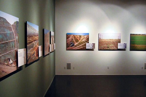
Ground-Up: Photographs of the Ground in the Margins of Los Angeles, an informative photograph and text display, was shown to the public at the Center’s exhibit space in Los Angeles for several weeks between September and November. The exhibition used soil maps of Los Angeles County as a tool for reexamining regional physiogeographic phenomena, as these curiously compelling maps provide a unique view of the landscape, and the human interventions within it.

Soil maps, published by the Natural Resources Conservation Service, a division of the U.S. Department of Agriculture, are aerial photographs with soil types superimposed on them, and they serve as general guides for a range of activities, from agriculture to mining and construction. While no substitute for the on-site investigation of a soil engineer, soil maps can provide an overview of large areas of land as well as features that are overlooked on U.S. Geographical Survey topographical maps.
In addition to describing natural features, soil maps provide a record of recent human interventions on the earth and serve as a guideline for future land uses. The maps come with tables assessing the suitability of soil types for a variety of activities such as sand and gravel mining, septic tank filter fields, agriculture and excavation.
The sites selected for representation in the exhibit exemplify common soil interactions, in the margins of Los Angeles. “As we looked at the utilization of soil for agriculture, mining and recreation, and the control of erosion necessary for the construction of Los Angeles’ ever expanding borders,” said the exhibit curator, Erik Knutzen, “we found that it is at these margins that the ground can be seen most clearly, before paving erases the layers of meaning that soil contains.”
The exhibit featured several large format photographs of these selected ground locations. The fine grain of the photographs matched the grain of the depicted ground, and the authority and weight that large, finely crafted images convey contrasted implicitly with the nonplaces that filled the frame of each exposure, suggesting to some the possible terminus of one limb of the tree of landscape photography.
More from the Margins in our Midst bus tour article